Cloudcroft's real trick is verticality — one direction is forest and trestle history, the other drops 4,400 feet into desert and White Sands. Plan around access, not distance.

2026 closures to know: Bluff Springs (ongoing), Oliver Lee entrance (construction through June). Check Lincoln NF alerts before you drive.
Filter
16 of 16 shown
Seven stops

Close to the village

Five-minute detours and in-town stops. The strongest daily rhythm is one forest walk, one sit-down, and one scenic drive — all from an 8,676-ft base.

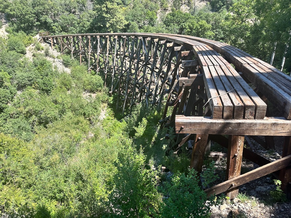
Mexican Canyon Trestle — a six-story 1899 wooden railroad trestle in a quiet canyon near Cloudcroft

Mexican Canyon Trestle Vista

History
Roadside overlook · 1899 trestle
5 min · quick stop Free

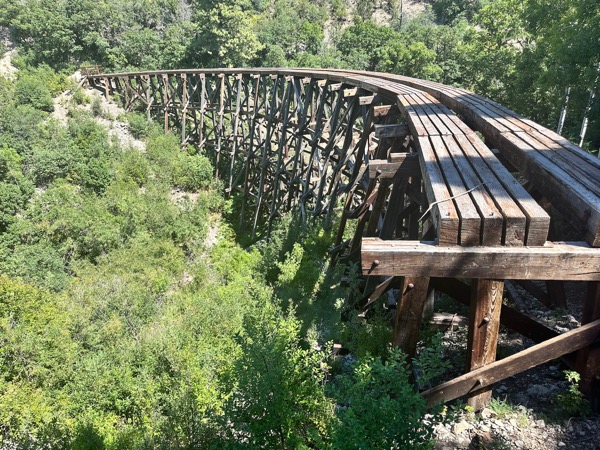
Roadside overlook with a direct view of the 1899 Cloud-Climbing Railroad trestle — six stories of preserved wood in a quiet canyon. Biggest scenic payoff in town for zero commitment.

Free Quick Photo stop
Historic Cloud-Climbing Railroad trestle bridge framed by green mountain forest

Trestle Recreation Area

Nature
USFS day-use site · picnic & trails
5 min · 1–4 hours $5 day-use fee

Clean Forest Service day-use site with picnic tables, water, restrooms, and direct trail access. Seasonal: closed December through March, reopens in spring.

Picnic Restrooms Trail access Closed Dec–Mar
USFS info →
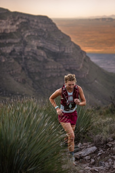
Cloudcroft-area forest trail with mountain ridges and sunset colors in the distance

Osha Trail

Hike
2.2-mi easy forest loop · 8,600 ft
5 min · 1–2 hours Free · no permits

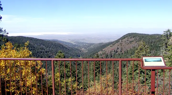
A family-friendly forest loop at 8,600 feet. Shaded fir and ponderosa with glimpses of White Sands off the western rim on a clear day. The local favorite for an easy walk.

Easy Free Shaded Family
Local history · pioneer village

Sacramento Mountains Museum

Museum
Cloudcroft's local-history museum
In town · 1–2 hours Volunteer-run

Local-history museum and pioneer village. Real value for understanding the railroad and resort identity of the town. Call to confirm hours — it's volunteer-run and seasonal.

Indoor Rainy day Call for hours
View on map →
Main street · shops & dining

Burro Avenue

Town
Shops, bakeries, tea, wine tasting
In town · 1–3 hours Walkable

The downtown main street: small shops, the Burro Street Exchange, bakeries, a tea house, Noisy Water Winery's tasting room, and easy mountain-village atmosphere.

Walkable Shops Dining Tasting rooms
Family ski area · tubing in summer

Ski Cloudcroft

Family
Small family ski area · south of town
10–15 min · half day Snow-dependent

Family-friendly ski area on the south side of town. Beginner slopes and lessons in winter; tubing and recreation in summer. Book tubing slots ahead.

Beginners Lessons Summer tubing Snow-dependent
View on map →
Forested scenic drive heading south from Cloudcroft along NM-6563

NM-6563 Scenic Drive

Scenic drive
15-mi drive south through deep forest
20–40 min · 1–3 hours Free

Fifteen miles of scenic drive on NM-6563 through deep forest with basin glimpses. The road itself is the experience — pull-offs, ridge views, and quiet pine corridors.

Scenic drive Free Forest
View on map →
Six destinations

Down in the basin

US-82 drops you 4,400 feet in under an hour — from alpine forest to Chihuahuan desert. White Sands, space history, pistachios, and one state park with a serious hike.

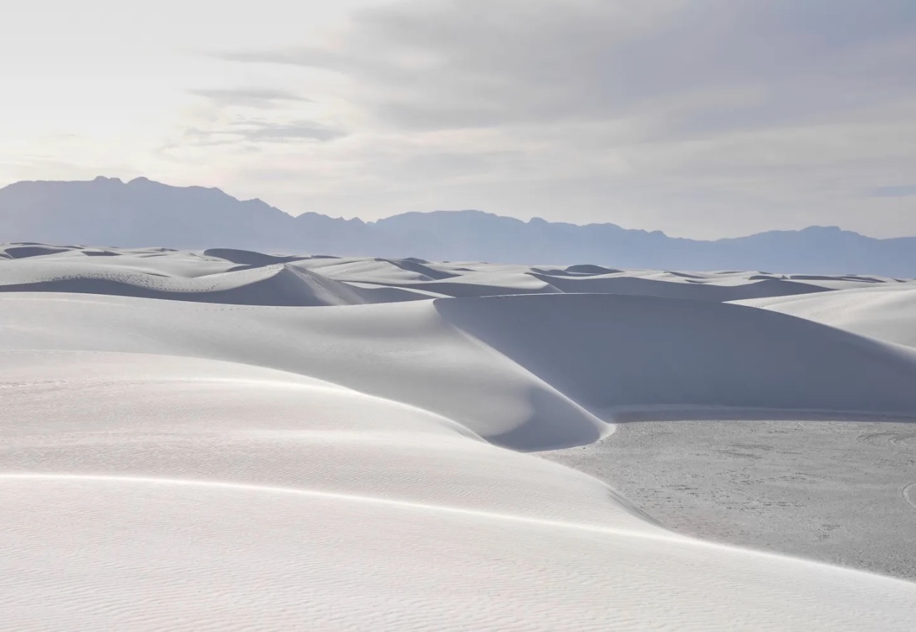
White gypsum dunes of White Sands National Park with the Sacramento Mountains rising behind

White Sands National Park

National Park
World's largest gypsum dunefield
35–45 min · half–full day NPS fee · watch US-70

The world's largest gypsum dunefield. Drive Dunes Drive, sled the dunes, stay for a sunset that feels otherworldly. Bring far more water than you think you need — heat is no joke.

Iconic Photography Sunset US-70 closures
NPS info →
Alamogordo · rockets & planetarium

NM Museum of Space History

Science
State museum with planetarium
30–35 min · half day Closed Tue

A well-curated state museum in Alamogordo with rockets, a planetarium, and the International Space Hall of Fame. Strong rainy-day or hot-afternoon backup.

Indoor Planetarium Family Closed Tue
Museum site →
Oldest zoos in the Southwest

Alameda Park Zoo

Family
Alamogordo city zoo
30–35 min · 1–2 hours Affordable

One of the oldest zoos in the Southwest. Smaller in scope but well-maintained and easy to pair with other basin stops. Best for families with younger kids.

Family Kids Affordable
View on map →
World's largest pistachio

McGinn's PistachioLand

Roadtrip
Working farm · ice cream · winery
35–40 min · 30 min–1.5 hr Free to visit

Working pistachio farm with the World's Largest Pistachio out front, an ice-cream parlor, and Arena Blanca Winery's tasting room. Book farm tours online — no walk-ins.

Novelty Ice cream Wine tasting Tours: book ahead
Farm site →
Dog Canyon · state park

Oliver Lee Memorial State Park

Hike
Desert oasis + Dog Canyon Trail
40–50 min · half–full day State park fee

Dramatic desert at the base of the Sacramentos — the steep Dog Canyon Trail and a surprising oasis of cottonwoods and water. Entrance under construction through June 2026.

Dog Canyon Desert oasis Less crowded Construction through June
Park site →
1869 mission · Granado Street

Tularosa

Village
1869 St. Francis de Paula · galleries
~32 min · 1–4 hours Free wander

Small basin village with the striking 1869 St. Francis de Paula Church and the galleries of historic Granado Street. Quieter than Ruidoso, less touristed than Cloudcroft.

Historic mission Galleries Quiet
View on map →
Three full-day or overnight trips

Full day or overnight

Worth staying the night. A bustling mountain sister-town, New Mexico's second-largest city, and two quiet Sacramento villages with real dark skies.

Mountain village · Ski Apache · Spencer Theater

Ruidoso

Town
Theater, lakes, mountain coaster
50–70 min · full day→overnight Operational post-2024 fire

A bustling mountain village with the world-class Spencer Theater, Ski Apache, a mountain coaster, lakes, and Midtown shops. Recovering and operational after the 2024 South Fork Fire.

Theater Ski Apache Mountain coaster Midtown shops
View on map →
Southern NM's cultural center

Las Cruces

City
Old Mesilla · farmers market · dining
~1 hr 35 min · overnight US-70 via White Sands

Southern New Mexico's cultural center: free downtown museums, historic Old Mesilla Village, a great Saturday farmers market, and real city dining. Best as an overnight rather than a day trip.

Free museums Old Mesilla Farmers market Real dining
View on map →
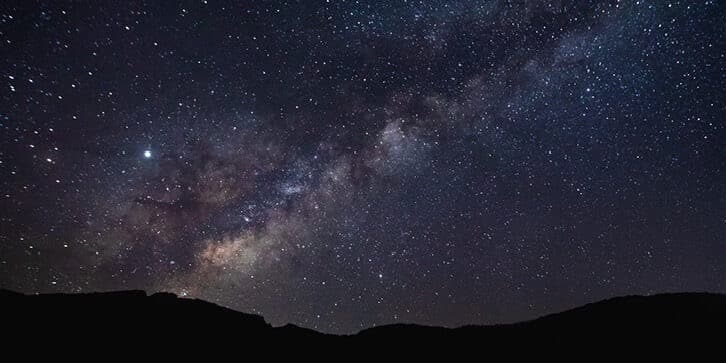
Milky Way arching over the Sacramento Mountains — dark-sky stargazing near Mayhill

Mayhill & Timberon

Dark skies
Stargazing + 18-hole golf
25 min – 1 hr · half day Remote

Two quiet Sacramento Mountains communities. Mayhill offers Lincoln NF trails and excellent dark-sky stargazing; Timberon is a small resort village with an 18-hole golf course and a lake.

Remote Stargazing Golf
View on map →
No trips match your filters. Cloudcroft's day-trip radius is narrow by design — try dropping a chip or two.

The regional picture

Cloudcroft sits on the Sacramento escarpment. US-82 is your drop into the Tularosa Basin; US-70 runs west to White Sands and Las Cruces. Ruidoso is up and north; Mayhill, Timberon, and the quieter Sacramento villages are back in the forest.

  1. 1White Sands National Park
  2. 2Mexican Canyon Trestle Vista
  3. 3Trestle Recreation Area
  4. 4Osha Trail
  5. 5Sacramento Mountains Museum
  6. 6Burro Avenue
  7. 7Ski Cloudcroft
  8. 8NM-6563 Scenic Drive
  9. 9NM Museum of Space History · Alamogordo
  10. 10Alameda Park Zoo · Alamogordo
  11. 11McGinn's PistachioLand
  12. 12Oliver Lee Memorial State Park
  13. 13Ruidoso
  14. 14Tularosa
  15. 15Las Cruces & Old Mesilla
  16. 16Mayhill & Timberon

Schematic only — distances and angles are approximate. The real picture is a 4,400-ft elevation drop from Cloudcroft into the Tularosa Basin via US-82.

Compare side-by-side

Select trips above (check the Compare box on any card)
Destination Region Drive time Time needed Vibe Indoor option 2026 access Notes
Nothing selected yet. Check Compare on two or more cards above to build a matrix.

Three days, three directions

Before you go

2026 closures to know

Bluff Springs remains under closure as of April 2026. Oliver Lee State Park's entrance is under construction through June 2026 — park access continues but expect disruption.

Stage 1 fire restrictions are in effect forest-wide through September 30, 2026 — check Lincoln NF alerts before any forest trip.

Roads & US-70 missile-range checks

US-70 (Alamogordo to Las Cruces via White Sands) is periodically closed for missile tests at White Sands Missile Range. Call 575-678-1178 for the day's status before driving that direction — closures can run several hours.

US-82 between the basin and Cloudcroft has steep grades, tight curves, and a tunnel. Snow, ice, or low clouds can change the drive substantially. Allow extra time and carry chains in winter.

Weather & the 4,400-ft elevation drop

The basin can easily run 30–40°F hotter than Cloudcroft in summer, and the sun at low elevations is much stronger. A comfortable morning hike at 8,676 feet becomes a dangerous afternoon at White Sands without water, shade, and a hat.

Reverse in winter: the basin is mild while Cloudcroft is icy. Plan the direction of your day trip around the weather, not the clock.

Cell service, rangers & hours

Cell coverage is unreliable outside the villages — download maps and the Recreation.gov listing before leaving. The Sacramento Ranger District is at 575-682-2551, 4 Lost Lodge Rd, Cloudcroft (M–F 9am–3pm).

Several of these destinations have seasonal or volunteer hours — Sacramento Mountains Museum, Trestle Recreation Area, Ski Cloudcroft summer tubing. If one stop is the whole reason you drove, call first.

Base-camp essentials.

Day trips work best with a real base camp. The lodging guide covers hotels, B&Bs, and cabins; the activities guide maps what else is worth doing in and around the village between excursions.

16 Nearby trips
4,400 ft Drop to the basin
8,676 ft Cloudcroft base