Cloudcroft History · Burro Roads
Odd Roads Lead to Cloudcroft History
Tracing the ghost of the James Canyon Public Highway along Burro Avenue — by Lynn Melton.
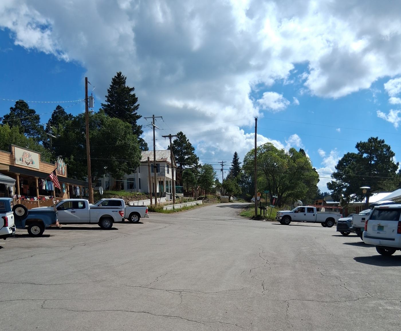
I invite you to stand near the intersection of Swallow Place and Burro Avenue — out of traffic, please — and look to the east, past the old red brick schoolhouse, toward the Cloudcroft Brewing Company. The old Texas Hotel seems to stop at the first white wall. Further along, this odd feature persists; the property lines seem not to reach the street. Indeed, this strip of land is not private land; it is the remnant of an old road, a road almost as old as Cloudcroft itself.
Take a look at the map, a cropped portion of a 1906 map of J.A. Eddy’s 5,000-acre “Cloudcroft Reservation”. Northwest of the intersection of Swallow and Burro, “North Cloudcroft”, Eddy’s subdivision for stores and tradesmen, has yet to be platted. Zenith Park is easy enough to find. More relevant to our concerns, two roads run along the north side of Zenith Park: Zenith Avenue and the James Canyon Public Highway.
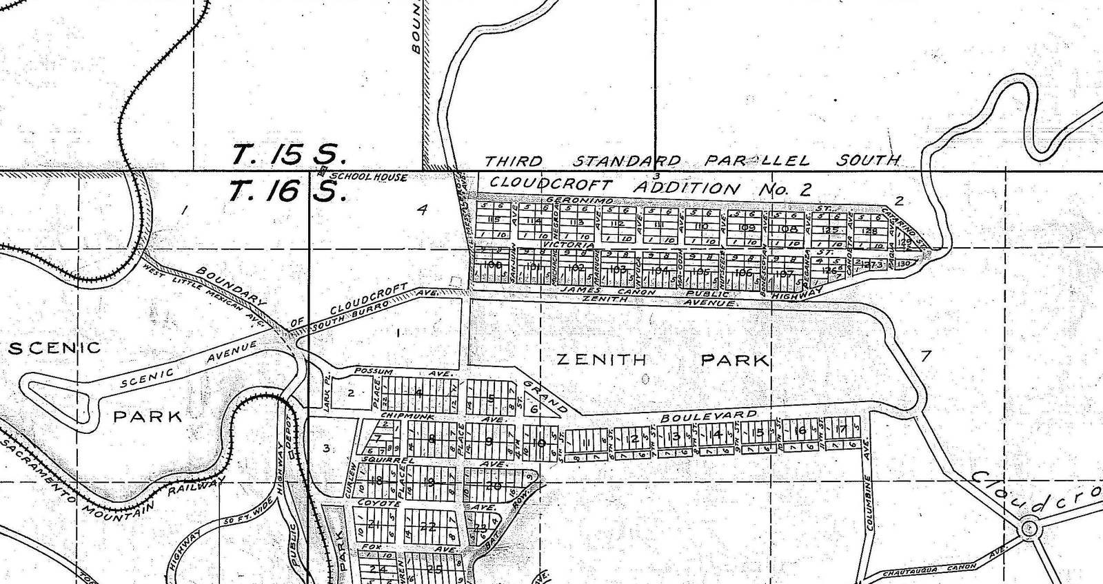
When J.A. Eddy purchased Eli McNew’s homestead in 1897, an old wagon road ran along the south side of the flat, boggy area that would become Zenith Park — perhaps it became Grand Avenue. Eddy wanted to sell lots with cool air to well-to-do El Paso residents, and in planning his Cloudcroft resort, he wanted to separate local farmers and ranchers from the elite lot owners.
Zenith Avenue provided a route for the elite to go around the north side of Zenith Park; the James Canyon Public Highway provided a route for the locals to bypass Zenith Park and, following Burro Avenue, reach Toboggan Canyon Road. Indeed, there was a fence separating Zenith Avenue and the James Canyon Public Highway, probably a jack leg fence, sufficient to warn locals and to keep free-range cattle out of Zenith Park.
With this in mind, it is time for a stroll — or perhaps a slow, stop-and-look drive — east along what is now labeled “Burro Avenue”. Sometimes the old road seems to be part of the access for a residence; sometimes it seems to be just a “too flat” area, well-separated from the residences, and sometimes covered with small trees.
When we reach the intersection of Paqua — named for an Apache warrior — and Burro, we seem to lose the old road. Time to look at the map again. Never mind that Paqua is not shown on the map; it resulted from a post-WWII replatting of Cloudcroft Addition #2. Aha! The James Canyon Public Highway made an odd bend to the northeast, followed by two sharp bends. Further to the east, the James Canyon Public Highway did connect to James Canyon near the present-day intersection of US 82 and NM 244, but that portion is not shown on the cropped map.
Look toward the light yellow house, and let your eye drift from the driveway, left past the white rocks, to the “too flat” area in the trees. Never mind the trees! The James Canyon Public Highway was abandoned by 1911. Very big trees could have grown in since then.
The James Canyon Public Highway went up onto the hill where the present-day Victoria Street runs. Stop for a moment and listen for the words of a long-ago wagon driver who was used to driving a heavy wagon up James Canyon and along the gently sloping old wagon road and crossing at the south side of Zenith Park. Now he must whip his team to make a steep climb. Perhaps he blames J.A. Eddy. His words will not be repeated in this family-oriented publication.
We cannot follow the James Canyon Public Highway from this end; it crosses private property. To approach from the east end, park your car near the intersection of US 82 and NM 244. Hike to the power pole on the west side of NM 244 that is nearest to the three culverts. Walk past the second power pole (with transformers) to the third power pole. Look forward and toward the other side of the canyon. Sight a mature ponderosa pine with a dead multi-branched tree on its left. Walk a few steps past and to the left of these trees, then pivot right. If you see a rock with elk bones on it, you are on the old James Canyon Highway. Look along it. There is still — after more than one hundred years — “too flat” to be seen. Follow it. Ignore the trees. When you come to a rocky pit, you know you are on the old road.
Why the rocky pit? The Cloudcroft slash pit is just ahead. It is a former quarry, likely developed in the mid-1950s when the present-day NM 244 was built. I suspect the old road was dynamited to stop rash drivers from speeding over the quarry edge.
Work your way toward the quarry. Turn left and follow the edge of the quarry to a stand of trees in a shallow depression. Aha! The old road. Follow the shallow depression along the ridge, past another rock pit (more dynamite!), over fallen trees, to a wide road near a small building. If you turn left, you will reach Victoria Street, but that would involve crossing private property. Please return as you came.
This portion of the James Canyon Public Highway does not appear on a 1911 map of Cloudcroft. Zenith Avenue has disappeared, and Burro Avenue runs east from Swallow Avenue, as it does today. Perhaps the angry wagon drivers prevailed!